
Symbolbild mithilfe von KI erstellt
Iranian Oil Exports Under Pressure
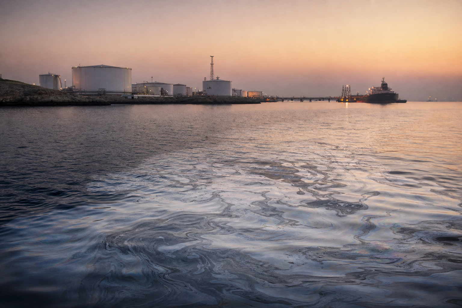
Oil Slick off Iran's Key Island Kharg: What's Behind It?
Satellite images show a conspicuous gray-white streak off the Iranian island of Kharg, indicating a possible oil slick. Copernicus images from May 6 to 8 were analyzed; the affected area is estimated at around 45 square kilometers. The finding is particularly explosive due to the strategic role of the island for Iran's crude oil exports – at the same time, it remains unclear what could have caused the contamination. This is precisely where the central problem begins: Satellite signatures can suggest a suspicion, but the cause and the perpetrator remain unclear without additional investigations.
Kharg as a Critical Point in Iran's Oil Export System
Kharg is considered the most important Iranian oil hub. Crude oil from the interior is stored temporarily on the island and then loaded onto tankers.
According to a data provider, around 90 percent of Iranian oil exports are handled through this location. Independent energy policy assessments also describe Kharg as the main terminal for Iranian crude oil exports; in market reports, the island's role is regularly highlighted as central to export logistics.
This gives a possible oil slick in this location an automatic second dimension: It is not only an environmental indicator, but potentially also a signal for technical disruptions in critical infrastructure – or for a security policy escalation in an already tense region. Any restriction at such a hub would at least have the potential to slow down supply flows, increase insurance risks, and influence risk premiums in energy markets.
No Reliable Explanation – and No Confirmed Link to Military Events
So far, it is not clear where the pollution comes from. Neither the exact cause nor the origin of the suspected oil slick is known.
The US military did report attacking military targets on the island since the end of February. However, whether there could be a connection between these attacks and the streak visible in satellite images has not been proven. There are also no statements that would directly classify the satellite findings: Neither the US military nor the Iranian mission to the United Nations in Geneva commented on the images.
Possible scenarios:
- Leaks or operational disruptions at facilities, pipelines, during loading, or in the vicinity of anchorages
- Pollution from shipping traffic in the region
Statements about intentional discharge or specific damage to facilities would be speculation at this point – there is a lack of publicly available, verifiable findings.
Why Satellites Make the Problem Visible – and Where Their Limits Lie
The fact that the streak is so clearly visible fits with today's ocean monitoring from space. European services such as satellite monitoring supported by EMSA (including radar-based methods) can detect oil slicks over large areas, track their spread, and provide authorities with clues as to where an event is developing. Radar systems are particularly useful because they work at night and partly independently of cloud cover.
At the same time, the limits of this method are crucial for classification: Satellite images can reinforce a suspicion, but they do not replace clarification of the cause. Wind, waves, algae, or other surface phenomena can influence signals; moreover, without additional data, it remains unclear whether the streak comes from a point source, several smaller discharges, or ship movements.
How Vulnerable Is Kharg Really? Alternatives and Bypass Logic
Despite Kharg's importance, an incident there would not automatically mean a complete export stop. Michelle Brouhard, Head of Policy and Geopolitical Risks at market analysis firm Kpler, points to alternatives: “However, the country has alternative export routes, including the Jask terminal, ship-to-ship transfers, and a network of tankers operating with limited visibility.”
This logic is central to strategic assessment: Iran's resilience in the oil business is not based solely on one terminal, but also on the ability to vary routes and methods – for example, via alternative loading points and transfers at sea. Such alternatives can cushion disruptions, but they are not equivalent: They are often more complex, riskier, more susceptible to monitoring, and can increase costs along the supply chain.
The Decisive Point Remains Open
The possible oil slick off Kharg is therefore politically and economically relevant because it became visible in the immediate vicinity of a core piece of Iran's export infrastructure – and because military developments around the island were reported at the same time. However, the currently reliable core remains limited: Satellite images show a conspicuous streak that, by shape and appearance, may indicate oil; a cause is not confirmed, and a connection with attacks has not yet been proven. Without independent investigations on site, the incident remains above all one thing: a warning signal, but not yet proof of what triggered it.